Hiking and Volcanoes in the Philippines: The Complete Guide
The volcanoes in the Philippines are the country’s most underrated reason to visit: a turquoise crater lake you reach by 4×4, a perfect cone you can frame through a ruined belfry, and a grassland summit at 2,900 meters where the sunrise arrives over a literal sea of clouds. This guide covers the best ones to hike or photograph, with honest prices, permit facts, and the safety rules that actually matter.
I’ve done most of these on repeat trips, dragged friends up a few, and talked my way out of one closed trail that I’m glad I didn’t push. The Philippines sits squarely on the Pacific Ring of Fire, which is exactly why the scenery is this good and exactly why access can change overnight. So before we get to the fun part, one rule: alert levels open and close trails, and the only source that counts is PHIVOLCS. Check it before you book anything. More on that near the end.
This is a deep dive on one slice of the country’s outdoor menu. For the wider picture — reefs, waterfalls, festivals and beaches — start with our guide to things to do in the Philippines, then come back here when you’re ready to climb something.
The Best Volcanoes in the Philippines to Climb (at a Glance)
Here’s the whole field on one screen. Prices are typical 2026 rates per person and move around, so treat them as ballparks and confirm when you book; peso figures convert at roughly PHP 58 = USD 1. “Permit” means a formal registration or accredited-guide requirement, not just an entry fee.
| Peak | Region | Difficulty | Permit needed? | Day trip or multi-day | Standout |
|---|---|---|---|---|---|
| Mt. Pinatubo | Tarlac / Zambales (Central Luzon) | Easy–moderate | Yes (coordinated tour + 4×4) | Day trip from Manila/Clark | Turquoise crater lake across ash fields |
| Taal | Batangas / Tagaytay (Luzon) | Easy (viewpoint) | Depends on alert level | Day trip from Manila | Lake-in-a-volcano-in-a-lake |
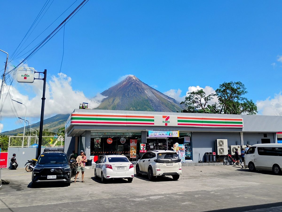
| Mayon | Albay (Bicol) | Easy (ATV/viewpoint) | No (for ATV & Cagsawa) | Day trip from Legazpi | The world’s most perfect cone |
| Mt. Pulag | Benguet (Cordillera, N. Luzon) | Moderate | Yes (DENR + medical cert) | Overnight (1N camp) | Sea of clouds at sunrise, ~2,926 m |
| Mt. Apo | Davao / Cotabato (Mindanao) | Hard | Yes (permit + accredited guide) | Multi-day (3D/2N) | Highest peak in the country, 2,954 m |
| Osmeña Peak | Cebu (Visayas) | Very easy | No (small fee) | Day trip / half day | Cebu’s highest point, biggest view for least effort |
| Pico de Loro | Cavite/Batangas (Luzon) | Moderate | Yes (registration) | Day trip from Manila | The monolith and a half-day summit |
| Mt. Batulao | Batangas (Luzon) | Easy–moderate | Small fee | Day trip from Manila | Rolling ridgeline, beginner-friendly |
If you only have time for one and you’re based near the capital, make it Pinatubo. If you want a sunrise you’ll bore people about for years, it’s Pulag. Everything else slots in around those two.
Mt. Pinatubo: The 4×4 and Crater-Lake Day Trip
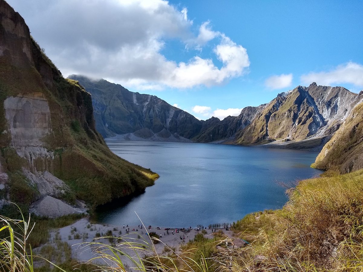
Pinatubo is the one I send first-timers to, because it delivers a genuinely surreal payoff for a beginner-friendly effort. Its 1991 eruption was the second-largest of the 20th century, and it reshaped Central Luzon into a Martian landscape of lahar canyons. Three decades on, the crater holds a calm, jewel-toned lake roughly 800 meters wide, and getting to it is half the adventure.
How the day actually runs
Tours leave Manila or Clark in the predawn dark — an unsociable 2am to 4am pickup — because the drive to the Santa Juliana jump-off in Capas, Tarlac takes around three to four hours from Manila (closer to one hour from Clark/Angeles). You don’t take your own vehicle up; private 4x4s aren’t allowed past the staging area, so you transfer into the local cooperative’s jeeps and bounce for 30 to 45 minutes across the braided lahar riverbed. Then it’s a hike of roughly 5 to 6 kilometers, about 1.5 to 2 hours each way, on mostly flat but rocky and sun-exposed ground. Round trip with the drive, you’re looking at a 12-hour day.
What it costs and what to know
A joined day tour from Manila typically runs PHP 2,500 to 4,000 (about $43 to $69) per person including the 4×4, guide, permits and usually a packed lunch; Clark-based trips can be a touch cheaper since the drive is shorter. Two things travelers get wrong. First, the crater swim is no longer allowed — the water carries variable sulfur and mineral content and the lake is deep with no safety cover, so the rule is firmly enforced. You don’t need the swim; the view does the work. Second, this is a heat endurance test more than a fitness one: start early, carry two liters of water minimum, and bring a buff or mask for the dust on the jeep ride.
Pinatubo sits in the same part of the country as the Cordillera trailheads, so if you’re building a northern loop, our Northern Luzon travel guide stitches the region together. And because most people do Pinatubo as a day trip from the capital, the logistics in our Manila travel guide will help you slot it into a city stay.
Taal: The Lake-in-a-Volcano (Check the Alert Level First)
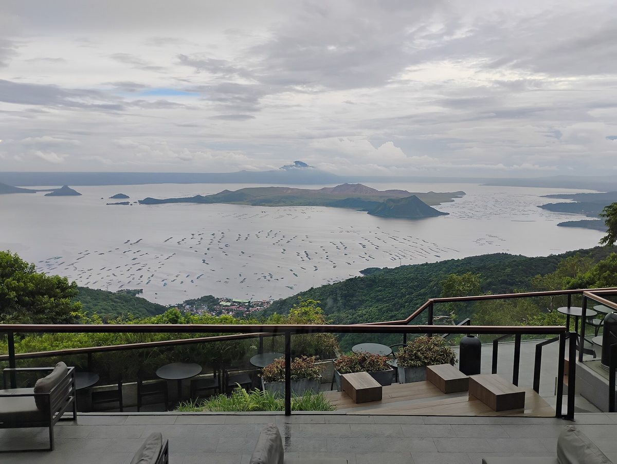
Taal is the strangest piece of geography on this list and the one with the biggest asterisk. It’s a volcano sitting on an island, in a lake, inside a much larger ancient caldera that is itself a lake — an island within a lake within a volcano within a lake. It’s also one of the most restless volcanoes in the country, only about 60 kilometers south of Manila, which is why it’s monitored so closely.
Why you probably can’t climb it right now
For years the classic Taal experience was a boat across the lake from Talisay followed by a short hike or horse ride to the crater rim. Here’s the honest 2026 picture: as of this update Taal is at Alert Level 1, and the entire Taal Volcano Island is a Permanent Danger Zone. PHIVOLCS keeps the Main Crater and the Daang Kastila fissure area off-limits even at Level 1, with phreatic (steam-driven) bursts recorded through the spring. Translation: the crater-rim hike is not a reliable plan, and depending on the day it isn’t available at all. This can change in either direction, so check PHIVOLCS the week you travel rather than trusting an old blog.
The reliable fallback: Tagaytay
The good news is that Taal’s best view doesn’t require setting foot on the island. The ridge town of Tagaytay, about a 1.5 to 2 hour drive from Manila, looks straight down onto the whole caldera, and it’s one of the easiest big payoffs in the country: a cool climate, a wall of restaurants and coffee shops along the ridge, and that layered volcano-in-a-lake laid out below you. I’d rather hand someone a Tagaytay coffee with that panorama than gamble on a closed trail. Go on a clear morning before the afternoon haze rolls in. Taal is the textbook day trip from the capital, and our Manila travel guide covers getting down to Tagaytay.
Mayon: The Perfect Cone and the Cagsawa Frame
If Pinatubo is the surreal one and Taal is the strange one, Mayon is simply the beautiful one. Rising 2,462 meters over Albay in the Bicol region, it’s the closest thing nature makes to a geometry-set triangle, and it’s been one of the most photographed peaks in Southeast Asia for a century. It’s also genuinely active, so summit climbs are usually restricted — but you don’t need the summit to fall for Mayon.
ATVs across the lava fields
The signature experience is an ATV ride across the hardened lava and ash on the volcano’s lower slopes, weaving toward the foot of the cone past the debris of past eruptions. Operators near Legazpi run routes from short loops to longer rides that reach a “black lava wall” from a more recent flow; budget roughly PHP 1,500 to 3,500 (about $26 to $60) depending on length, with self-drive or tandem-with-a-guide options. It’s accessible, it’s a blast, and it gets you closer to the mountain than any viewpoint.
The Cagsawa Ruins
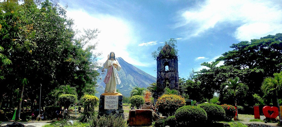
The other unmissable Mayon moment is free and quiet: the Cagsawa Ruins, the belfry of a church buried by the catastrophic 1814 eruption, now a lone bell tower with the perfect cone framed behind it. Get there at sunrise for the cleanest light and the smallest crowd; entry is a token fee. Bicol has a second headline act too: down the coast in Sorsogon, Donsol is where you swim with whale sharks that nobody is feeding. Mayon is an easy fly-in from Manila to Legazpi, and the surrounding Bicol coast pairs naturally with the waterfalls and adventure spots in our guide to waterfalls in the Philippines if you want to round out the trip.
Mt. Pulag: Luzon’s Sea of Clouds at Sunrise
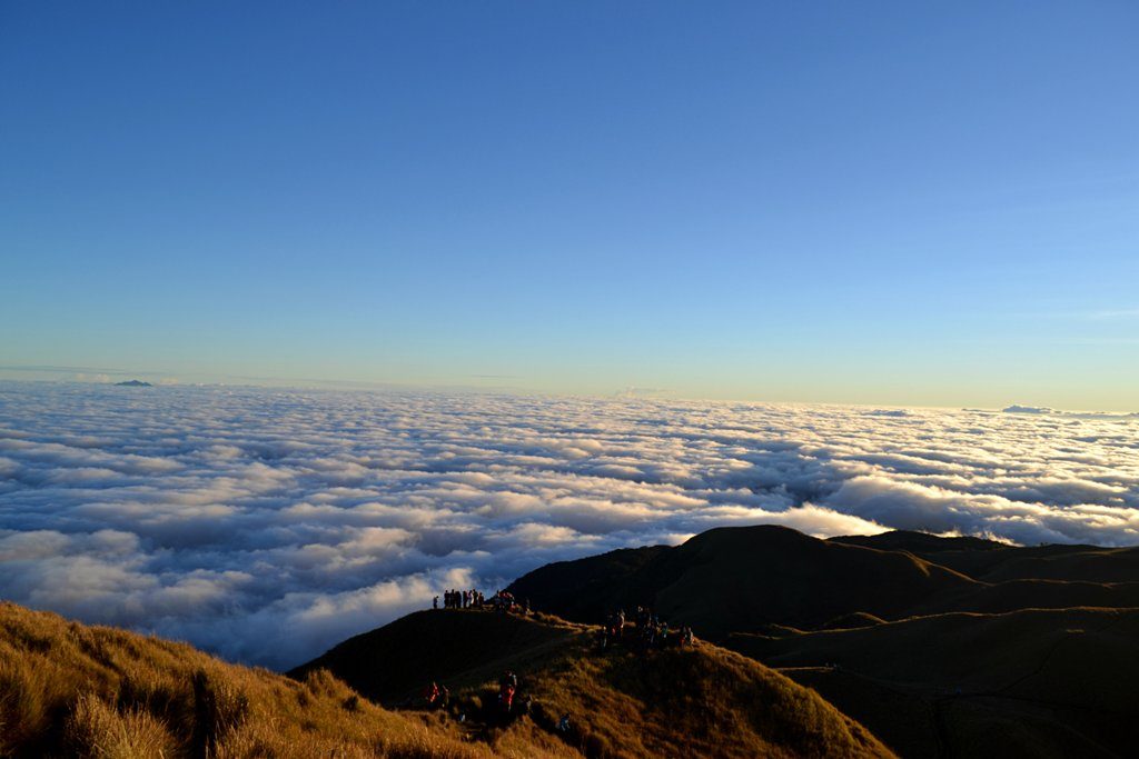
Pulag is the hike that converts skeptics. At roughly 2,926 meters it’s the highest peak in Luzon and the third-highest in the country, and its summit is an open grassland plateau famous for one thing: the dawn “sea of clouds,” when the valleys below fill with white and you stand on an island of grass above the weather. The dwarf-bamboo slopes glowing gold at first light are the postcard, and they earn it.
The Ambangeg trail and the overnight plan
Most visitors take the Ambangeg trail, the gentlest of Pulag’s routes and the reason the mountain is approachable for fit beginners. It’s not a technical climb, but it is a real one: you register at the DENR ranger station, attend a short orientation, then hike through mossy forest into grassland to a designated campsite (Camp 2 is the usual base). You sleep there, wake in the cold dark, and push for the summit to catch sunrise. Camping at the summit itself is prohibited, so the overnight-at-camp, summit-at-dawn rhythm is standard. Plan it as a two-day trip out of Baguio.
Permits, cold and altitude
Pulag has real requirements, and they exist for good reason. You need a DENR permit arranged in advance — slots fill in peak season — plus a medical certificate confirming you’re fit for the altitude, and an accredited guide. The big rookie mistake is underdressing: this is one of the coldest places in the Philippines, regularly dipping near or below freezing before dawn, and people genuinely get hypothermic in shorts and a hoodie. Bring proper layers, a warm hat and gloves, a headlamp, and a sleeping bag rated for cold. A guided overnight package typically runs PHP 2,500 to 5,000+ (about $43 to $86) per person depending on group size and inclusions, on top of transport from Baguio. Pulag sits deep in the Cordillera, so our Northern Luzon travel guide is the companion piece for planning the wider region.
Mt. Apo: The Highest Peak, Done Over Several Days
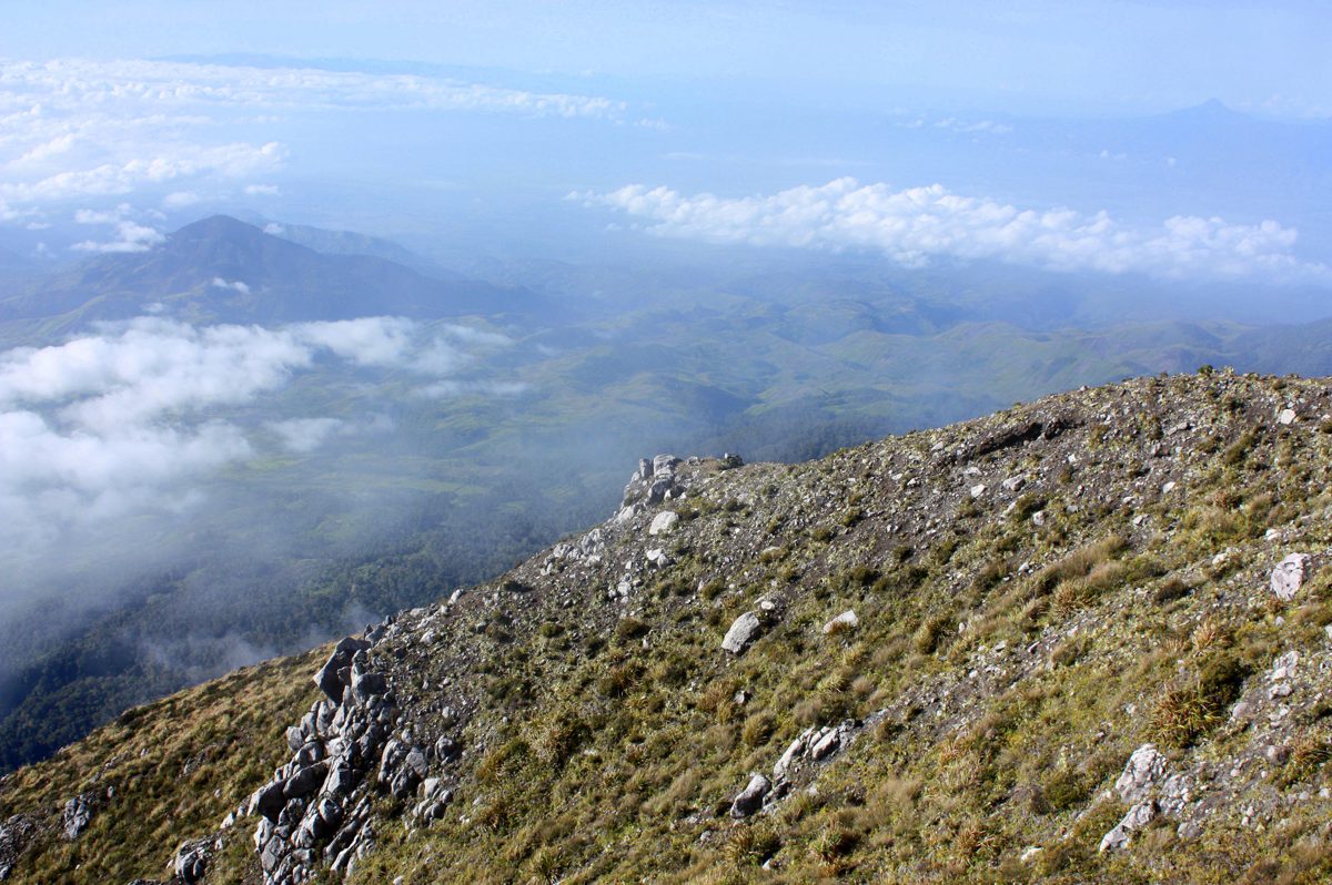
Apo is the big one — 2,954 meters, the highest point in the Philippines, straddling Davao del Sur and Cotabato in Mindanao. It’s a potentially active volcano, but it reveals itself less through eruptions than through sheer ecological range: you climb out of tropical rainforest, through mossy cloud forest and grassland, past sulfur vents, to a boulder-strewn summit, all in one trip. This is a committed multi-day trek, not a day hike.
Routes and timing
The standard itinerary is 3 days and 2 nights, which builds in acclimatization and positions you for a sunrise summit. Several trails serve the mountain — the Sta. Cruz route (with its famous boulder face), Bansalan, and Kapatagan among them — each with different jump-offs and roughly 9 to 14 hours of total trail time spread across the days. You’ll want an accredited guide, a permit, cold-weather gear and waterproof packing, because Apo’s protected-area rules are strict and its weather is serious. The dry months, broadly December through May, are the window; June to November brings typhoon risk and slick, dangerous trails.
Apo isn’t a casual add-on — treat it as the centerpiece of a Mindanao trip and give it the training and respect it asks for. If your legs aren’t there yet, the peaks below are the smarter starting point.
Easy Wins: Osmeña Peak, Pico de Loro and Mt. Batulao
Not every great view costs you a 2am alarm and a medical certificate. Three peaks give an outsized payoff for modest effort, and they slot into otherwise relaxed itineraries.
Osmeña Peak (Cebu): biggest view, least work
At 1,013 meters, Osmeña Peak is Cebu’s highest point, and reaching the top is barely a hike — a 20 to 30 minute walk from the trailhead in Dalaguete through jagged, Chocolate-Hills-style ridges. The reward is a sweeping view across the saw-tooth hills to the coast, for an entry fee of around PHP 30 to 100. It’s the easiest “big” summit in the country and a perfect sunrise stop if you’re already exploring south Cebu.
Pico de Loro and Mt. Batulao (near Manila): half-day classics
South of Manila, two peaks anchor the capital’s day-hike scene. Pico de Loro (Mt. Palay-Palay), on the Cavite–Batangas border, is famous for its “Parrot’s Beak” monolith jutting from the summit ridge; it’s a moderate climb with a registration requirement and is doable as a long day trip. Mt. Batulao, in Nasugbu, Batangas, is the friendly one — a rolling, scenic ridgeline with a small fee, beginner-appropriate, and close enough to knock out before lunch. Both are roughly two to three hours from Manila and ideal for a first taste of hiking in the Philippines without committing to the Cordillera.
Hiking in the Philippines: Guides, Permits, Seasons and What to Pack
Stepping back from individual peaks, here’s how hiking in the Philippines actually works once you’re on the ground. A little planning saves a lot of grief, and most of it comes down to four things: when you go, whether you need a guide, what the permit situation is, and how you pack for tropical altitude.
The two best windows: March–May and October–November
The national dry season runs roughly December through May, and within that, two windows stand out for mountains specifically. March to May gives you the firmest trails and the clearest summit air, though it’s also the hottest stretch in the lowlands — great for Pulag and Apo, sweaty for Pinatubo. The shoulder weeks of October to November, as the rains taper, can be glorious for the sea-of-clouds peaks. June through about September is the southwest monsoon: trails turn to mud, river crossings swell, and typhoon risk spikes, especially in Luzon. For a fuller breakdown of the climate by month, see our guide to the best time to visit the Philippines.
Guides and permits are usually mandatory, not optional
This trips up a lot of independent hikers. On the serious mountains — Pulag, Apo, Kanlaon, Pico de Loro — an accredited local guide and a registration or permit are required, not a suggestion, and rangers do check. It’s partly safety (weather and volcanic conditions change fast) and partly community livelihood; the guide fees support the people who keep the trails open. Arrange Pulag and Apo permits well ahead in peak season. Easier spots like Osmeña Peak and Batulao just charge a small entry fee at the trailhead. When in doubt, book through an accredited operator rather than winging it.
Altitude, and what to actually bring
Two of these peaks cross 2,900 meters, which is high enough that you’ll feel the thinner air and, more importantly, the cold. Don’t underestimate it: a tropical country can still serve you near-freezing temperatures before dawn at Pulag or Apo. My standard high-peak kit: proper layers including a warm insulating top, a windproof or rain shell, hat and gloves, a headlamp with spare batteries, two-plus liters of water, trail snacks, sunblock and a buff for dust and sun, broken-in shoes with grip, and a cold-rated sleeping bag for overnights. For the lava-field and day-trip volcanoes, swap the sleeping bag for extra water and sun protection — the enemy there is heat, not cold.
Safety and the PHIVOLCS Alert Levels, Explained
This is the section I’d make you read before any of the others. The Philippines lies on the Pacific Ring of Fire, with more than 20 active volcanoes, and access to them is governed by a formal alert system you should understand before you plan.
What the alert levels mean
PHIVOLCS — the Philippine Institute of Volcanology and Seismology — runs a 0-to-5 scale for each active volcano. In plain terms: Level 0 is quiet, Level 1 is low-level unrest (still with a Permanent Danger Zone you can’t enter), Level 2 is increasing unrest, Level 3 means magma is near the surface and hazardous eruption could come within weeks, Level 4 means a hazardous eruption is imminent, and Level 5 means one is in progress. Crucially, even at the lowest levels there’s a Permanent Danger Zone — a fixed radius around the vent that’s always off-limits because steam-driven blasts and rockfalls can happen without warning. That’s exactly why Taal Volcano Island stays closed even at Level 1.
How to use this as a traveler
The practical rules are simple. Check the current alert level and bulletins on the PHIVOLCS website in the days before you travel, not months earlier — levels change, and a trail that was open last year may be closed today (or vice versa). Never cross a danger-zone boundary, even if the volcano looks calm and other people are doing it. Book accredited guides who know the current conditions. And build flexibility into your plans for the active peaks: have a fallback (Tagaytay for Taal, a different mountain for a closed trail) so a change in status doesn’t sink your whole trip. Respecting the system isn’t being timid; it’s the difference between a great story and a tragic one.
Frequently Asked Questions
Is it safe to visit volcanoes in the Philippines?
Yes, when you follow the rules. The volcanoes on the standard tourist trail are visited safely by huge numbers of people every year. The key is to check the current PHIVOLCS alert level before you go, never enter a marked Permanent Danger Zone, and hike active peaks only with accredited guides. Conditions change, so staying informed is the whole game.
Can you still swim in the Mt. Pinatubo crater lake?
No. Swimming in the Pinatubo crater lake is no longer allowed and the rule is enforced by local authorities and guides. The water has variable sulfur and mineral content, the lake is very deep, and there’s no safety cover. You don’t need to swim to enjoy it — the turquoise lake set against the crater walls is the payoff, and the view is the reason people come.
Which volcano is the easiest to visit near Manila?
For a pure viewpoint, Tagaytay overlooking Taal is the easiest big payoff, about 1.5 to 2 hours from the city. For an actual hike, Mt. Batulao in Batangas is the gentlest, and Pinatubo is the most rewarding day trip if you don’t mind a predawn start. Taal’s volcano island itself is often closed, so plan around its alert level.
How hard is the Mt. Pulag sea of clouds hike?
Via the Ambangeg trail it’s moderate and achievable for fit beginners — not technical, but a real overnight effort at altitude. You camp partway up and summit before dawn. The main challenges are the cold (near freezing before sunrise) and the permit and medical-certificate requirements, which you should sort out in advance, especially in peak season.
What is the highest volcano in the Philippines?
Mt. Apo in Mindanao, at 2,954 meters, is both the highest volcano and the highest peak in the country. It’s a potentially active volcano usually climbed over a 3-day, 2-night trek with an accredited guide and a permit. Mt. Pulag in Luzon (about 2,926 m) is the next-highest commonly hiked summit.
When is the best time to hike volcanoes in the Philippines?
Aim for the dry season, roughly December to May, with March to May giving the clearest summit views and firmest trails (though the hottest lowland heat). The October to November shoulder is also good for the sea-of-clouds peaks. Avoid the June to September monsoon, when mud, swollen rivers and typhoons make mountain travel risky.
Photo Credits
- Mayon Volcano, Albay — via Wikimedia Commons (see image attribution)
- Taal Volcano from Tagaytay — via Wikimedia Commons (see image attribution)
- Mount Pulag sea of clouds — via Wikimedia Commons (see image attribution)
- Mount Pinatubo crater lake — via Wikimedia Commons (see image attribution)
- Osmeña Peak, Cebu — via Wikimedia Commons (see image attribution)
- Cagsawa Ruins and Mayon — via Wikimedia Commons (see image attribution)
- Mt. Apo summit view — via Wikimedia Commons (see image attribution)
Sources and Further Reading
- PHIVOLCS — volcano alert levels and bulletins
- PHIVOLCS — Volcano Alert Level schemes (Taal, Pinatubo, Mayon, Kanlaon)
- Philippine Department of Tourism — official travel portal
- eTravel — the official Philippine arrival registration site
About this guide: PhilippinesTourism.org is an independent resource for planning Philippine travel. Trail access and volcano alert levels change — always check PHIVOLCS and local guides before you climb. Verified June 2026.